Fall in the Smokies, Part 1

Fall in the Smokies, Part 1

GSM102017003
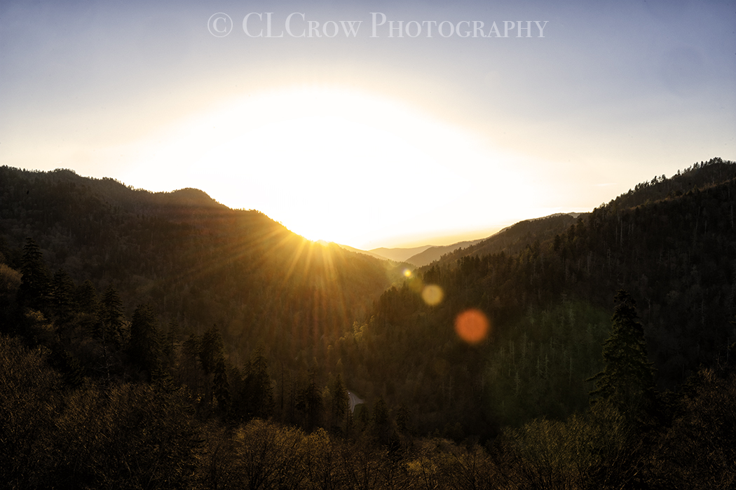
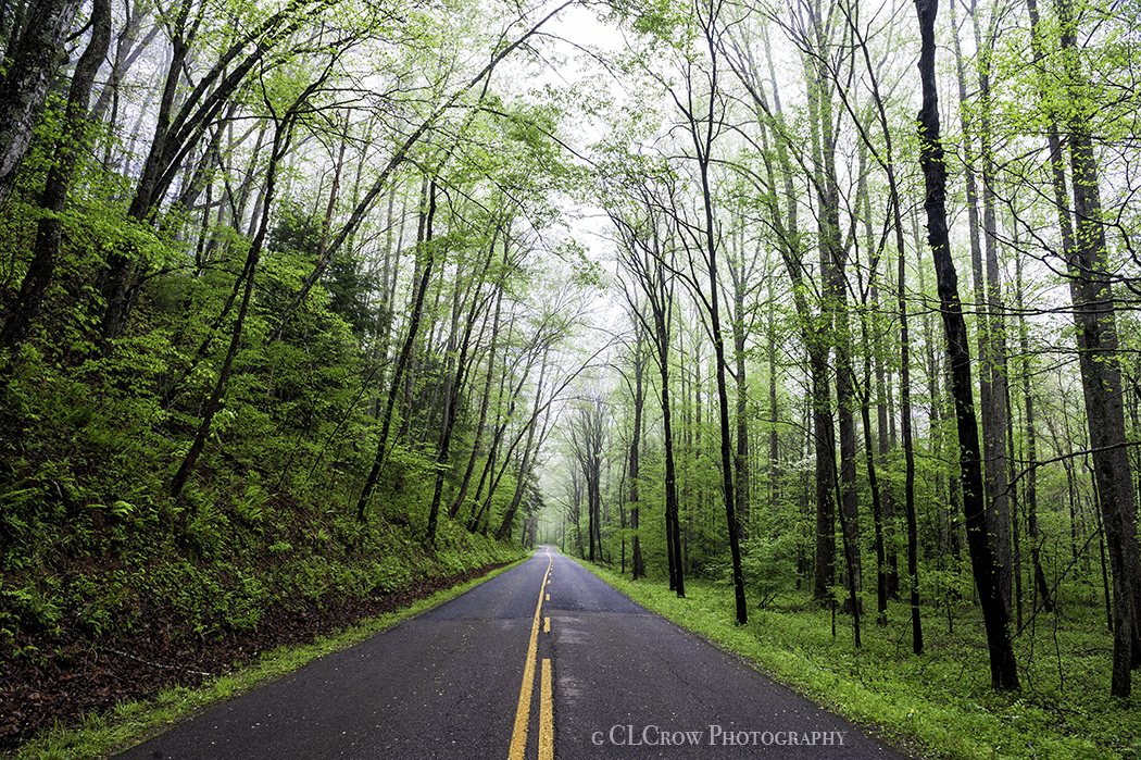
I had planned to leave for my vacation straight from work but because the apartment office was closed at lunch when I went to pick it up the lens I rented from BorrowLenses.com, I had to wait until after work to pick it up.  I Finally headed to the Smokies for my vacation.  Yes, I came back from the third time in a year.  Traffic in Conway was fun like always.  I was hoping I would arrive when fall colors were at peak but unfortunately, lowest elevations are still quite green.

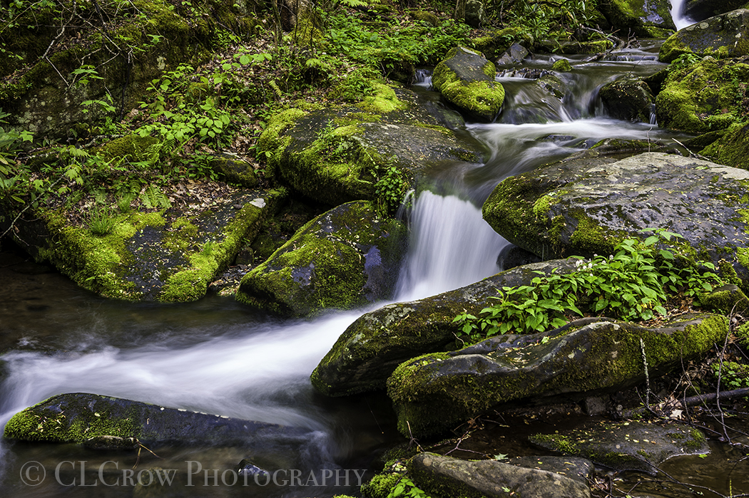
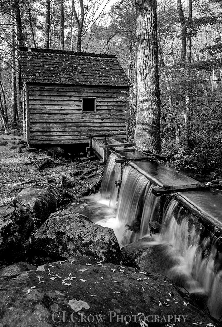
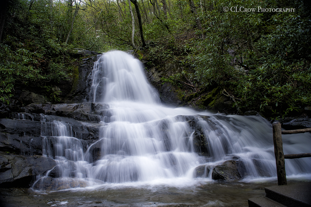
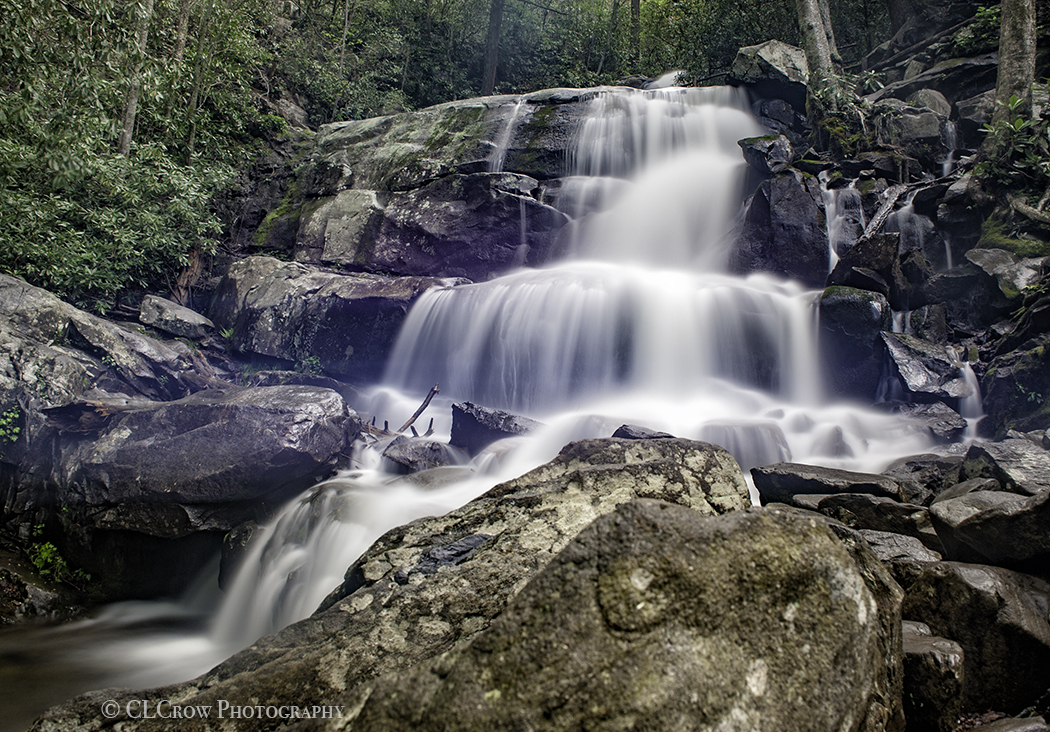
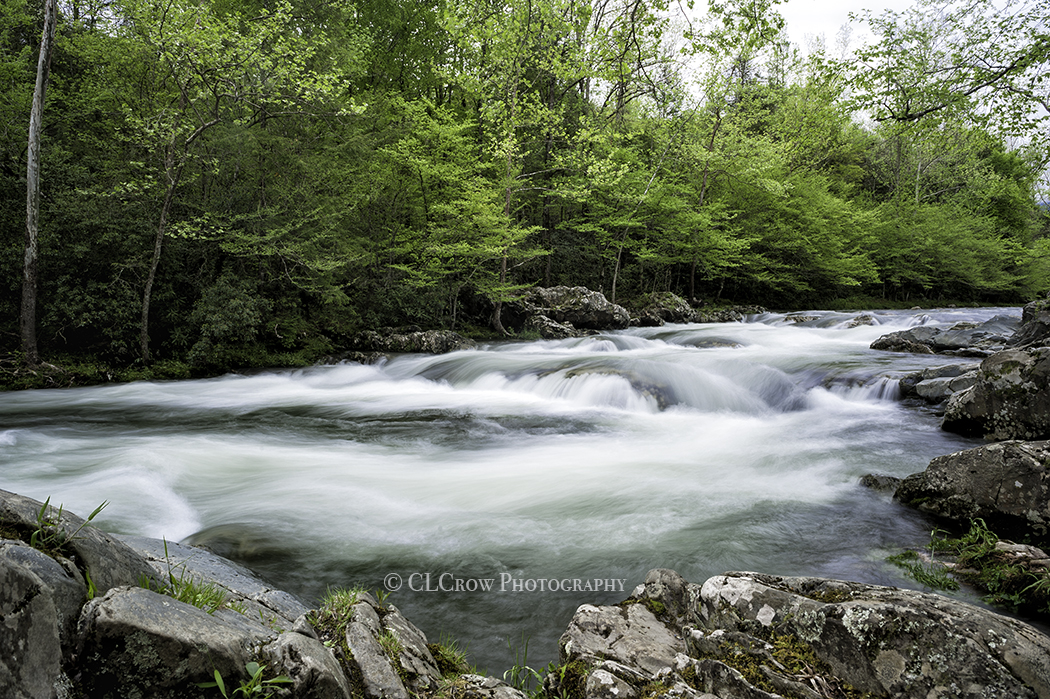
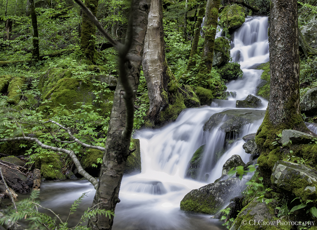
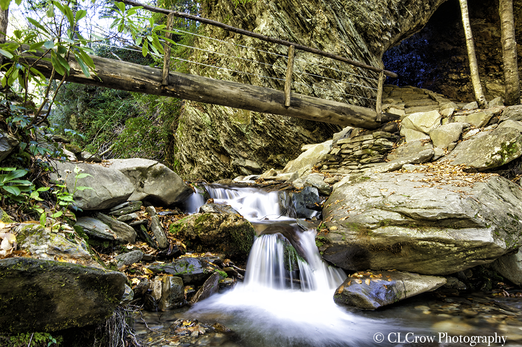
For my first full day in the Smokies I had originally decided to head to Newfound Gap overlook for sunrise then Alum Cave Bluffs but I was lazy this morning and decided just to head to the Bluffs.  Alum Cave Bluffs is a very popular hike off Newfound Gap so best to get their early to find a parking space. It was a balmy 33 degrees so I was wearing a fleece jacket over sweatshirt and long sleeve tee shirt. The Alum Cave Bluffs trail is 4.6 miles with an elevation difference of 1,145 feet. The good news is its uphill to the Bluff so downhill coming back.  On the trip up, I came across quite a few photo opportunities of raging water but as I started this hike before sunrise, I decided to wait until my trip back.  I am not as in good shape as I would like to be and had to take a few breaks.  Other than that, the hike was going well until I got to the Arch which is a series of steep, narrow steps going through mountain arch.  I was fine going up but was very nervous about the return trip. I do not handle heights well. The photo on the left is a bridge leading to the Arch.  I also stupidly didn’t bring two things I needed, water and my sunglasses.  A nice guy I met on the trail gave me a water and I had to deal with not having my sunglasses until I got back to my car. 

On the way back down the trail, I stopped at multiple spots to take photographs of little waterfalls in the river.  I started the hike around 7:30 and finished around 11:30.  My next stop was Sugarlands Visitor Center.  I think everyone decided at this time to stop there, the place was packed. 

I then headed into Pigeon Forge for lunch.  My first thought was the Old Mill (I want to get photos of it) but it was also packed (recurring theme in October in and near Great Smoky Mountains National Park). As I was driving, I saw Lil Black Bear Cafe.  Small little hole in the wall place but cheeseburger was very good.  As I was waiting for my burger, I edited a few of the photos from the hike to Alum and posted one to Facebook.

This blog post was longer than I expected so I will continue the day in the next blog.  


Cathie and Tim’s Excellent SC Adventure Part 3

 Cathie and Tim’s Excellent SC Adventure Part 3 is Tim’s last full day in Myrtle Beach.  

IMG_0567 2The first thing we did was head to Flapjack’s Pancake House for breakfast since we didn’t get to go to one while we were in the Smokies.  

Our next stop was Surfside Beach Pier so Tim could see the damage done to the pier from Hurricane Matthew last October.  The pier is now 50 ft shorter.  Surfside Beach Town Council voted this week to replace the pier with a concrete one.  Probably a good idea.  We both took photos.  Not surprising Tim took many more than I did and I apparently didn’t take any of the pier, just the machinery in the water so they could refurbish the sand on the beach..

Since we tied on Friday night, we decided on a rematch for mini golf.  I had a coupon for a free round at Treasure Island Golf so we headed there.  This is the first of many rounds and courses we will play.  Sunday really was Mini Golf Day.  We ended up playing two rounds (and might have played extra holes because the people in front of us were slow).  I beat Tim the first round 49-45 and apparently we didn’t keep score on the second round.

IMG_0578We headed to Sea Captain’s House for lunch.  We both had she crab soup and the appetizer crab cakes.  They have the best she crab soup.

It is hard to remember what order we played the different courses. I believe the next course was Jurassic Golf.  We then headed toward Springmaid Pier but ended up going to Shipwreck Island and playing both courses. Tim won both rounds 53-43 and 50-44. We both had a hole in one on the first course and I had hole in one on the first hole on the second course.

Our next stop was Springmaid pier which was almost totally destroyed by Hurricane Matthew.  I haven’t heard when the resort plans to rebuild it. 

I took him back to his hotel and I went back to my apartment so we could get ready for dinner at Rioz Brazilian Steakhouse.  It was a little more than I planned to spend and that was after 2 $25 gift certificates but the food was fantastic. 

After dinner we headed to yet another mini golf course, Spyglass Adventure Golf which was suggested to us by the guy at Treasure Island Golf because they are both owned by the same person.  I won this round 50-44 and had a hole in one.

And then on the way home, we stopped by Captain’s Hook’s Adventure Golf and played yet another round which I won 47-45.  I wasn’t kidding when I said we played many rounds.  Tim has all the scorecards and texted me the final scores so I thought I would include them in my blog post. 

It was fun having a day to play tourists.  The only problem was that I wore my flip flops almost the entire day so my feet were sore. It was a great day.

The two photos were taken with my iPhone.  The one on the left is Surfside and the one on the right is Springmaid.

Cathie and Tim’s SC Excellent Adventure Part 2

Cathie and Tim’s SC Excellent Adventure Part 2

DHHD082017003Cathie and Tim’s Excellent SC Adventure Part 2 starts with us getting breakfast at Eggs Up Grill in Myrtle Beach before heading to Charleston for the day.  On the way to Charleston, we stopped by the old haunted mansion to take some photos since Tim hadn’t been there before.  (it is directly across highway 17 from the road you turn on to go to Hampton Plantation).  Someone else was there and told us that the land had been sold. Hopefully they won’t tear down the old house, many photographers shoot that house.  

Our next two stops were stops so I could get stamps in my National Parks Passport, Charles Pinckney National Historic Site and Fort Moultrie (which is part of Fort Sumter National Monument).  At Fort Moultrie a park ranger told me that Charles Pinckney wasn’t a true national park which I pointed out that it had its own place in the passport unlike Fort Moultrie.  His response "I never said this was a true site and I normally work at Fort Sumter."

MILH082017001Our first photography stop was Drayton Hall. Before our tour of the house, we walked the grounds and took photos of the house.  Tim continued his fascination with oak trees and took some photos of the beautiful oak trees on the grounds. I normally just incorporate them into my shots like the photo above where the house is framed with the branch from the tree.

After stopping for lunch, we headed to Edisto Beach State Park so I could get a stamp in my SC State Parks book (6 down, 39 to go). I am not keeping track of the National Parks because there are 417, I doubt I will be able to get them all but I will certainly try. 

We then headed to Folly Beach to take photos of the Morris Island Light House.  The waves were huge and it was very windy, found out once we left it was because there was a storm in the Atlantic making its way to our coast.  

We stopped at Smoky Oak Taproom for dinner and then headed back home. Unfortunately it was on this trip that I somehow managed to shatter the LCD screen on the D300s which is going to cost $250 to fix. 


Cathie and Tim’s Excellent SC Adventures Part 1

Cathie and Tim’s Excellent SC Adventures Part 1.

SSB082017003On Friday morning I headed to Raleigh to pick Tim up at Raleigh Durham International Airport. After picking him up, we headed to Firebirds at Streets of Southpoint Mall to have lunch with my friend Beth Linthicum who I used to work with when I worked at WellPath. It was great seeing Beth.

We then headed to Myrtle Beach to start our next adventure. After Tim checked in at his hotel, we headed to my apartment so he could meet the newest member of my family, the little monster, I mean kitten Brady. Unlike my other cat, Tux, Brady isn’t afraid of people so Tim actually got to see one of my cats. Tux was hiding under the bed.

Our next stop was the Socastee Swing bridge to shoot sunset with Dan and Carolyn Thompkins.   While we were shooting a boat came through so the bridge was opened.  The bells are quite loud when they are preparing to lower the gates.  Right before it opened back up to traffic, a firetruck appeared with the lights and sirens blaring.  It was great finally meeting Dan and Carolyn.

We headed to Chick Fil A for a quick dinner before our last adventure for the night which was playing miniature golf. Myrtle Beach has MANY miniature golf courses.  Tim had told me when were planning the trip that he wanted to play miniature golf while he was here.  I enjoy playing but I was a little skeptical as we are both quite competitive and I was thinking it could get interesting.  

The hardest thing about playing is which course to pick. I had heard very good things about Mt. Atlanticus Minotaur Golf so we headed there.  They have an awesome locals discount (all the miniature golf courses have locals discounts).  Tim and I grabbed golf clubs and picked which color ball we wanted to use.  I chose purple and Tim chose orange so we were either FEDEX colors or Clemson.  I got a hole in one of the first hole and Tim’s reaction was priceless, I wish I had caught it on video. He was convinced that I spent the weeks leading up to his visit practicing on the course.  I didn’t, that was actually the first time I ever played that course.   He was pouting until we got to the third hole where he got a hole in one.  It was quite funny. Tim and I were tied at the end of the round.

I dropped him off at his hotel and then headed home. I edited a couple of photos and posted one before heading to bed.  It was a great start to our weekend together. 


Solar Eclipse

 Solar Eclipse

Eclipse082017001It’s finally August 21, 2017, Solar Eclipse Day.  I decided to head to Hampton Plantation in McClellanville because it was almost ground zero.  The first thing I did when I woke up was check out the weather in McClellanville, Columbia, Pawleys Island and Georgetown.  It had 50% chance of scattered showers in Georgetown, Pawleys Island and McClellanville.  I also checked weather for Gatlinburg but there was no way I was going to drive 6 hours one way plus they were expecting record number of people.  Columbia had cloud cover but given this was Mother Nature, I decided to take a chance and head to McClellanville and left at 7:30am since I knew traffic would get heavier as the day progressed.

52502067126__F47502E8-77FA-485B-9A9D-FF0E96124A85Luckily traffic was light and I made it there around 8:30am. I found my spot and prepared for the eclipse. I was amazed on how much room was available for people to watch it but the parking lots filled quickly.  It was a beautiful day though it was very hot.  There were a few clouds in the sky both luckily no storms. I checked the weather again and it changed from scattered thunderstorms to just cloudy. I spent the morning getting to know the people around me. 

The eclipse finally started.  We had a few clouds block a little bit of it but the first half of the eclipse went well as you can see in the photo.  

Unfortunately as the eclipse progressed, a storm cloud was heading our way from the opposite direction.  It was a race to see if totality would happen before the storm cloud moved in. Unfortunately Mother Nature had to be her sadistic self and the storm cloud took over a minute before totality so I missed the best part of the eclipse but it was cool to see how dark it got.  

I packed up my car and headed home.  What was normally an hour drive turned into four hours because everyone and their brothers, sisters, uncles and parents were on the road at the same time.  Traffic was stop and go pretty much from the Georgetown County line to Murrells Inlet. Heavy traffic is so much fun when you drive a manual transmission.  

I uploaded the eclipse photos into my computer, picked the best one from each phase and merged them into one photo.  What took me the longest besides uploading 260 raw photos into my computer was deciding how I wanted them to go across the screen and spacing them.  If I would have been able to shoot the entire eclipse, I would not have used as many phases.  

It was an amazing experience watching and shooting the solar eclipse, I just wish I would have been able to see the totality.  That was the part I was most looking forward to shooting. Oh well, I guess I will have to head to Texas in 2024.

Solar Eclipse: A Week Before

2017 Solar Eclipse: A Week Before

The path of the 2017 Solar Eclipse is starting in Oregon and making its way across the country.  As much as I would love to be in Great Smoky Mountains National Park, it is going to be crowded and patience has never been my strong suit.  Luckily the eclipse runs right through the middle of South Carolina going over McClellanville. 

The first full solar eclipse in years is going to happen on a Monday afternoon so of course I decided to take the day off because I’m not missing this possibly once in a lifetime event especially since I live 30 minutes from where there will be totality of the eclipse (full solar eclipse).  I actually put in for the day off in May.

The next important thing is deciding where to take go, I could stay in Myrtle Beach which will have 99.6 percent of the totality.  To many people that is enough but it is not for me. I want the full eclipse so that leaves anywhere from Pawley’s Island to Charleston.  Charleston is going to be crowded and don’t really feel like dealing with that much traffic.  No matter where I go, without doubt I will not be the only person there shooting the eclipse.As much as I would love to go to the point in Pawley’s Island, there isn’t a lot of parking available so I"m going to head to Georgetown where the totality will be the longest and hopefully I can find a place even if it is just a parking lot.  Since its a solar eclipse int he middle of the day, the subject will be high in the sky so I don’t have to worry about people in my shots.

Another very important item, a filter for my camera that is strong enough for the camera to be pointed at the sun for a few hours except that short window during the totality.  Luckily my wonderful friend Tim is sending me his because I waited to long to order one.  I now have to decide if I want to shoot with the Nikon D300s or the Nikon D700.  The D700 is the better camera but its a full frame camera so using a 80-400mm the most zoom I will get it 400mm.  Because the D300s is a crop sensor, the 400mm lens now becomes 560mm. Ordered my special solar eclipse glasses from Tidelands Health so my eyes are taken care of as well.

This week will be spent watching videos, reading everything I can about settings so on the day of the eclipse I am ready and I don’t miss the photos of a lifetime because I don’t know what I am doing. And I will also be practicing. Hopefully Mother Nature will behave and we will have clear skies.


Return to the Smokies Day Four

Return to the Smokies Day Four.

RFLE042017001The day did not start out well.  Tim woke up feeling even worse and Mother Nature decided to be her sadistic self.  It was overcast when I woke up but it wasn’t long before the skies opened up and it started to pour.  I spent the morning editing a few photos and writing the blog posts for the previous three days.  I don’t have a working laptop so I’m using mobile LR and Photoshop on my IPad Pro for editing and also writing the blog posts.  Unfortunately the box for the blog posts is only so big and once you get past that you can’t see your words so all my blogs will have to be finished once I get home and have access to my iMac.  As the day progressed I could feel a cold coming on.  Not surprising considering how much time Tim and I spent together.

RFMBW042017001We decided to grab lunch at A&W and then head to the park since it looked like there might be a break in the weather.  See comment about sadistic Mother Nature.  Best laid plans.  It started to pour as soon as we arrived at the restaurant.  I haven’t been to an A&W since I was a kid and I’ve always loved their root beer.  I even bought an official A&W mug, I ordered the small one (shot size) but she rang up the largest one. Since she needed a manager to void the order, I told her not to worry about it and just took the large one. 

After lunch there were still thick clouds over the mountains that we couldn’t see them so we headed back to the hotel where I did more editing.

The storms finally cleared around 4pm so we headed to Roaring Fork Nature Trail for our final photo outing together.  Part of the road is rough for someone who is deathly afraid of heights.  I was getting very nervous on the narrow one way road which has a steep drop off just past the asphalt and since we took my car and Tim doesn’t know how to drive a manual transmission, I had to drive. Since neither Tim nor I were feeling up to it we opted out of both the Rainbow Falls and Grotto Falls hikes.  They are definitely on the list for the next trip but Tim will be driving next to time so I can feel safe on the inside part of the road.  We stopped and took more photos of the flowing river because neither of us just don’t have enough long exposure river shots from this trip. We also stopped at the old mill.

We stopped at a wood fired pizza place on the way back to the hotel.

Return to the Smokies Day Three

 Return to the Smokies Day Three

SPHD042017001Finally our first full day of sun.  We decided to head back to Cade’s Cove to shoot Sparks Lane and then head into Townsend to get breakfast. Sparks Lane was open to traffic which made get photos of the road fun because we kept having to move to the side to let the cars pass. Its a very popular road.  We met Joseph Rossbach who was doing a seminar with a nice couple from Germany.

One of the vehicles that we moved out of the way for stopped down the road so they could take photos but the ruined our shots. While we were waiting, I wandered into the mist covered field and took photos of and dew covered spiderwebs.  I wandered down the road because I had seen some deer crossing but they were on the other side of the stream covered lane and I wasn’t going to get my running shoes soaked.  I asked the driver how long he would be because we wanted to take photos and his response was "don’t you guys have photoshop?"  I love inconsiderate people. He eventually did leave.  

GSMLE042017003Instead of heading to Townsend for breakfast, Tim wanted to stop by Sugarlands Visitor Center to pick up a collectible Great Smoky Mountains National Park poster he had seen on our other stops into the center. On the way out of the park, we pulled off to take photos of the river.  I think we’ve been there at least 4 or 5 times.  Since we were closer to Gatlinburg than Townsend, we decided to head to Pigeon Forge for breakfast which was quickly turning into brunch. 

We planned to go to Flapjacks Pancake house which we bothered remembered was on the right side of the road.  We still didn’t see it when we got to Sevierville so we turned around and headed to the IHOP we saw.  Flapjacks in Pigeon Forge was on the opposite side of the road, the one we were both thinking was in Sevierville and we just hadn’t gone far enough.  Oops. 

We then headed back to the park. We headed toward Elkmont campground to hike Jake Creek trail hoping it would have some thick foliage to filter the harsh sunlight. Only problem was the trail was closed at Cucumber Gap Trail so we took a few photos of the small stream near the parking lot and then headed back to the hotel because Tim wasn’t feeling well.

MO04217001Our last photo excursion of the day was heading up to Morton Overlook in Newfound Gap to get the sunset.  Tim was thrilled to see Tony Sweet who’s workshop he attended in the Badlands.  I had a little trouble with my exposure but as you can see, I think the photos out ok.

Another great day in the Smokies.  

Return to the Smokies Day Two

Return to the Smokies Day Two was supposed to be the first full day of sunshine but we are talking about Mother Nature and add the Great Smoky Mountains in and it does not always happen that way. It didn’t rain though and clouds can make for some dramatic photos.

LFLE042017001It was my turn to drive.  Our first stop was Laurel Falls.  We parked in the parking lot, grabbed our gear and started the 2.6 mile round trip hike up the mountain. The good news is it is almost totally up hill to the falls so its downhill back to the parking lot.  The path is paved but not always in the greatest shape in a few spots.  The trail comes to a bridge that cuts the waterfall in half.  We set up our tripods on the rocks and took photos keeping in mind that edge was not very far.  Both Tim and I took photos for tourists and had one of them return the favor and take one photo of us.  The first photo that we are both in facing the camera.  Neither of us like getting our photos taken.

LFLE042017002After we finished taking photos, we decided to hike down the rocky trail to the bottom of the falls.  It was slippery and not easy to navigate but we made it down but not before scraping my calf which I would repeat climbing back up.  We took many photos of the lower falls.  Laurel Falls is popular so there will be quite a bit of editing to do on these photographs since many hikers decided to wear bright neon colors and stand in the way when I’m taking the photo. The nerve of some people.

We planned to head to Roaring Fork Nature Trail for our next destination but instead of heading toward Gatlinburg where the entrance is, we turned onto Newfound Gap.   We could have done the hike to Alum Cave Bluffs but the parking lot was overflowing and neither of us are a big fan of crowds. Chimney Tops was closed so we decided to go to Clingman’s Dome.  We were both a little sore and tired from the hike to Laurel Falls but how hard can a half a mile hike be. Famous last words. 

CDHD042017002We passed a few scenic overlooks that we planned on stopping at on the way back down the mountain.  After I parked my car, we took some photos from the edge of the parking lot and then headed to make the hike to the observation tower.  The hike is relatively short but because of the steep incline, the NPS rates the hike as strenuous and believe me it is but the view from the top is well worth the hike.

The driving trip down the mountain was fun for me as the road has a lot of twists and turns but I don’t think Tim felt the same way.  It probably wasn’t a lot of fun for a passenger.

Greenbrier042017002Our last trek for the day was down Greenbrier Road which runs along the Little Pigeon River.  Another great area to capture photos.  Ramsey Cascades Falls is off this road unfortunately it was closed due to a bridge being out.

On the way back to the hotel we stopped at Burger Barn for dinner.  All in all this was an amazing and tiring day.  

Return to the Smokies Day One

My Return to the Smokies Day One.

GSM042017001Tim and I decided to take one of our trips together to Great Smoky Mountains National Park.  I fell in love with the park when I visited last year.  The first full day in the Smokies was an experience.  In all fairness, everyday in the Smokies is an experience.  

Our original plan before we set out was to go to Cade’s Cove to shoot Sparks Lane first thing in the morning because fog had set in and due to the fact that Cade’s Cove is in a valley, it could make for some great photos.  We then planned to head to the Knoxville Zoo and because of the weather was forecasting rain in the afternoon, we planned on going to a distillery and then maybe the Alcatraz East Crime Museum.

How our day actually went was almost completely different.  Luckily even though it was overcast all day, it never actually rained.  We headed to Cade’s Cove like we planned but things went a little sideways once we entered the park and headed there.  The road to the Cove was closed. We pulled into the parking lot at Metcalf Bottoms.  We walked a little down the road but didn’t see anything and decided to turn around because Cade’s Cove was still 8 miles away.

Deer042017001Like many places in the park, a river flows right by the road and since they’ve had a lot of rain, the river was raging.  It also has a lot of large boulders so it makes for some great long exposure photographs.

The first thing we took photos of was the closed road.  The road runs through the mountains with dense foliage and with the fog it made for some dramatic photos.  We then moved to a bridge over the river which we kept having to move off because its one lane and cars kept coming.  I eventually moved down to the river banks to get some photos.  I finally saw a Park Ranger truck approaching and I flagged him down which is when I found out that there was a tree in the road but more importantly there was another way to get to the Cove which was definitely the scenic route.  It took us through Townsend, TN then back into the park.  We first stopped at the Cades Cove store and picked up a few souvenirs.  We then headed over to Sparks Lane to get some shot.  Our next stop was John Oliver’s Cabin.I took a few photos and then wandered in the woods behind the cabin and took a few photos of a stream while Tim was taking his shots.  Once we got back to the car, Tim decided to take some photos of the mountains.  We didn’t leave the parking lot for like 20 minutes because Tim was waiting for a raptor that was flying overhead to fly into his shot.  It never did.  Anyone who knows me knows that I am NOT a GSMLE042017001patient person.  I was tempted to run him over with the car.  We were finally on our way.  Our next stop was John Cable Grist Mill.  Like the cabin, I wondered into the woods while Tim was shooting the barn behind the Mill.  I saw movement of a large animal.  Unfortunately it wasn’t a bear, it was a few deer.  I turned to head back when I saw three does nearby.  Tim soon joined me and we took quite a few photos.

 We stopped at Cades Cove store to grab a quick bite to eat and then headed over to Tremont Road which has the Mid Prong Little River flowing along side the road where there are many places to pull over to and take photos including waterfalls as you can see on the photo.

We stopped off at Corky’s BBQ for dinner and then headed back to the hotel.  It was a great first day.